Anatomy of a Massacre Part II: The Killing
Anatomy of a Massacre: Mapping the Execution of Syrian Army […]
4 December 2014

Anatomy of a Massacre:
Mapping the Execution of Syrian Army POWs at Tabqa Airbase
By Joseph Adams
December 4, 2014
Part II: The Killing
Introduction, the Gathering Silos, Thoul Nayel, and Conclusion
Open in full screen view. Click the center of the map once, then navigate to the left pane and click each numbered step in order to review how, when, and where the Tabqa airbase massacre unfolded. Each number corresponds to numbered sections within the text.
i. Introduction
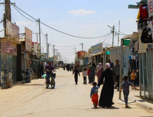
The defeat of regime forces at Tabqa airbase drove hundreds of soldiers into the desert to seek refuge in Hama province. While an unknown number escaped, an estimated 160 regime soldiers were captured by the Islamic State following battle around Al-’Ajrawi farm. Disparate prisoners groups were forced to strip and march north up to 12km in the early afternoon sun. They arrived at the Gathering Silos, where they were piled in trucks, bowing their heads, driven to their final destination.
In Part II, Open Syria picks up the trail of these men, following them about 93km east to the end of their journey. Arabic-language news and social media point to Ma’amal Al-Qarmeed, a terracotta brick factory about 5km east of A-Raqqa as the execution site for all 160 soldiers.
Ma’amal Al-Qarmeed is not on any publicly available map. To identify Ma’amal Al-Qarmeed in satellite imagery, Open Syria geo-locates a video of the factory area, recorded in 2013. Satellite imagery of Ma’amal Al-Qarmeed does not match physical and man-made features, such as the position of the setting sun relative to a long dirt embankment and the placement of electricity transmission towers, filmed at the execution site in “Strike Fear.” *
Open Syria searched the area immediately surrounding Ma’amal Al-Qarmeed for the execution site. About 300 meters northwest of Ma’amal Al-Qarmeed lies Thoul Nayel. This inactive archaeological site appears an exact match to the execution site recorded in “Strike Fear” at 2:26-3:26.
Open Syria posits that it was at Thoul Nayel, on August 27 at 6:30-7:00 pm, that Islamic State fighters stood behind and opened fire on a line of 160 Syrian army prisoners of war, lying face down along an earthy embankment.
1. The Gathering Silos:
Packed in Trucks
Location: 35°45’45″N, 38°19’40″E
To arrive at the Gathering Silos, at least three prisoner groups marched up to 12km from Sites 1 and 2, settlements approximately 9km southwest and 14km west of Al-’Ajrawi farm at 35°39’31 N, 38°19’14 E and 35°41’52.10″N, 38°14’58.00″E, respectively. They begin walking at 12:00-1:00 pm, arriving at the Gathering Silos at 1:00-2:00 pm.
1.1. East to Thoul Nayel: ~93km on the M4 Highway
Location: 35°45’50.49″N, 38°20’55.29″E
August 27, 1:00-2:00 pm: In “Strike Fear” at 2:18, prisoners arrive at the Gathering Silos, where they were packed in trucks for transport to the execution site. Seven seconds later in “Strike Fear,” one of the prisoner transport vehicles is seen on a well-paved road.
Open Syria believes this road is the M4 highway, which begins in Aleppo and extends into Iraq. According to shadow measures, this single vehicle was travelling east at 1:30-2:30 pm.

A well-paved highway immediately outside the Gathering Silos turns out to be the M4 highway stretching from Aleppo into Iraq, as seen in “Strike Fear” at 2:25. Source: Bing Maps.

The only vehicle in “Strike Fear” showing the transport of prisoners to the site of their execution from the Gathering Silos. Source: The Islamic State. “The lions of the Islamic State drive Nusairi herds to their doom_Strike fear in those who are behind them.” August 2014. 2:25.

A 3-D model of the prisoner transport vehicle geo-located to the M4 highway. At this point, a shadow measurement provides the approximate time (1:30-2:30 pm) and direction (east). Source: Google SketchUp.
2. Ma’amal Al-Qarmeed:
Is this the execution site?
Locations: Ma’amal Al-Qarmeed, 35°56’5.67″N, 39° 6’52.05″E
Arabic-language news and social media report Ma’amal Al-Qarmeed, a terracotta brick factory roughly 5km east A-Raqqa city, as the final destination of prisoners marching barefoot across the desert.Open Syria put that hypothesis to the test. As Ma’amal Al-Qarmeed is not on any publically available map, Open Syria searched for videos or photographs to geo-locate the site.
A search of Ma’amal Al-Qarmeed in Arabic on YouTube turned up two videos purportedly filmed at the site. Both videos were uploaded to YouTube on February 9, 2013:
“Ma’amal Al-Qarmeed in A-Raqqa at a Distance of 4km East of A-Raqqa.”
“Digging in at Ma’amal Al-Qarmeed 4km East of A-Raqqa.”
The first video, henceforth referred to as “Ma’amal Al-Qarmeed in A-Raqqa,” is rich with perspective and landmarks; the cameraman records a panoramic view of Ma’amal Al-Qarmeed, showing four transmission towers, a water tower sitting on rows of pylons beyond the patchy roof of a building and a cratered excavation site surrounded by a deep trench and curving road.
Open Syria searched satellite imagery for the aforementioned landmarks to pinpoint the exact location of Ma’amal Al-Qarmeed. These features are all visible in satellite imagery; we therefore geo-locate where “Ma’amal Al-Qarmeed in A-Raqqa” was filmed at 35°56’5.67″N, 39° 6’52.05″E, approximately 5km east of A-Raqqa city, the provincial capital.
Points 2.1-2.5 present a comparison between unique man-made features photographed in satellite imagery of Ma’amal Al-Qarmeed, with structures recorded in “Ma’amal Al-Qarmeed in A-Raqqa.” Each map point includes feature coordinates and corresponding video scene times.

Open Syria geo-locates the precise location of the video “Ma’amal Al-Qarmeed in A-Raqqa,” where Arabic-language news and social media place the executions. In order to confirm this report, Open Syria searches the area for possible execution sites that match “Strike Fear.” Open Syria concludes that Ma’amal Al-Qarmeed is not the correct site. Source: Author. Google Earth. “Ma’amal Al-Qarmeed 4km from A-Raqqa.” Source: Google Earth.
2.1. Twin Two-Pylon Towers
Location and Scene Time: 35°56’9.34″N, 39° 7’0.34″E. “Ma’amal Al-Qarmeed in A-Raqqa 4km from A-Raqqa.” :04.

Twin two-pylon towers visible here in satellite imagery match the towers recorded in “Ma’amal Al-Qarmeed in A-Raqqa” at :03. Source: Google Earth.

Source: “Ma’amal Al-Qarmeed in A-Raqqa 4km from A-Raqqa.” February 2013. :03.
2.2-3. Water Tank and Factory
Location and Scene Time: 35°56’13.91″N, 39° 7’8.43″E. “Ma’amal Al-Qarmeed in A-Raqqa 4km from A-Raqqa.” :03.

A patch-roof building and a water tank seen in satellite imagery match structures recorded in “Ma’amal Al-Qarmeed in A-Raqqa” at :03. Source: Google Earth.

Source: “Ma’amal Al-Qarmeed in A-Raqqa 4km from A-Raqqa.” February 2013. :03.
2.4. Twin Unibody Towers
Location and Scene Time: 35°56’11.61″N, 39° 6’53.21″E. “Ma’amal Al-Qarmeed in A-Raqqa 4km from A-Raqqa.” :04.

Twin unibody towers in satellite images are similar to those filmed in “Ma’amal Al-Qarmeed in A-Raqqa” at :04. Source: Google Earth.

Source: “Ma’amal Al-Qarmeed in A-Raqqa 4km from A-Raqqa.” February 2013. :04.
2.5. Road
Location and Scene Time: 35°56’4.19″N, 39° 6’56.66″E. “Ma’amal Al-Qarmeed in A-Raqqa 4km from A-Raqqa.” :21.

A road sandwiched between a trench and a green field, visible here in satellite imagery, matches up with “Ma’amal Al-Qarmeed” at :21. Source: Google Earth.

Source: “Ma’amal Al-Qarmeed in A-Raqqa 4km from A-Raqqa.” February 2013. :21.
The dusty terrain and two-pylon transmission towers at Ma’amal Al-Qarmeed appear similar to the execution site recorded in “Strike Fear” at 2:27-3:26. However due to the position of photographed towers, and the absence of a recognizable dirt embankment oriented along an east-west access, we conclude Ma’amal Al-Qarmeed is not where the mass execution of approximately 160 Syrian army soldiers occurred on August 27.
Open Syria now presents Thoul Nayel, where the massacre actually occurred.
3. Thoul Nayel:
Geo-locating the Execution Site
Location: Thoul Nayel 35°56’20.11″N, 39° 6’38.90″E
After geo-locating Ma’amal Al-Qarmeed and confirming that the final prisoner massacre did not occur at this location, Open Syria began a search in the area for a place matching the execution site filmed in “Strike Fear” at 2:27-3:26.
At 35°56’20.11″N, 39° 6’38.90″E, Open Syria identifies an archaeological site Wikimapia calls Thoul Nayel, roughly 300m northwest of Ma’amal Al-Qarmeed. Henceforth, we refer to 35°56’20.11″N, 39° 6’38.90″E as the Killing Berm. The Killing Berm lies within 15m of where the execution occurred. The remainder of this investigation presents how Open Syria identified the Killing Berm.
The following map pins mark the locations of various “Strike Fear” scenes. Each scene matches a distinct man-made or geographic feature at Thoul Nayel, also visible in satellite imagery and sun position charts. Open Syria includes high-resolution imagery of each identified feature, numbered 2.2-2.6, including coordinates and corresponding “Strike Fear” scene times.

Open Syria presents satellite imagery of the southeast end of the abandoned archaeological site Thoul Nayel. This site lies roughly 500m northwest from where “Ma’amal Al-Qarmeed in A-Raqqa” was filmed. Each map pin corresponds to a “Strike Fear” scene containing a unique geographic or man-made feature, also visible in satellite imagery or sun position charts, leading to the location of the execution site. Open Syria visits each in turn.
2.2. T-Type Pylon: Arriving at the Execution Site
Location and Scene Time: 35°56’21.36″N, 39° 6’41.06″E. “Strike Fear.” 2:27.
Open Syria returns to “Strike Fear” to examine prisoner execution scenes, which reveal seven unique man-made and geographic features, and then identifies the location of each identified feature in satellite imagery. Together, all seven features point to the position where the Islamic State massacred approximately 160 Syrian army soldiers on August 27.
August 27, 4:00-5:00 pm: In “Strike Fear” at 2:27, half-naked prisoners are forced out of a green prisoner transport vehicle. Several men, either dead or unconscious, hang over the side.
Two important clues lie in the background. First, a T-type electricity pylon in a patchy green field. Second, the length and direction of the truck shadow tell us the men tumbling from the truck gates were facing approximately south at 4:00-5:00 pm.

A T-type electricity pylon in a patchy green field, visible as prisoners fall out of a green Islamic State prisoner transport vehicle. Source: The Islamic State. “The lions of the Islamic State drive Nusairi herds to their doom_Strike fear in those who are behind them.” August 2014. 2:27.
Using satellite imagery, Open Syria identifies a T-type electricity pylon in a patchy green field 6m from the Killing Berm.

A satellite image of the T-type pylon in the patchy green field, matching “Strike Fear” 2:27, 6m from the Killing Berm. This is the first man-made feature Open Syria geo-locates and matches at Thoul Nayel. Source: Google Earth. The Islamic State. “The lions of the Islamic State drive Nusairi herds to their doom_Strike fear in those who are behind them.” August 2014. 2:27.

The truck shadow, seen in the Islamic State video, is approximately parallel to where the pylon shadow would fall. This means “Strike Fear” 2:27 occurred between 4:00-5:00 pm. Source: SunCalc. The Islamic State. “The lions of the Islamic State drive Nusairi herds to their doom_Strike fear in those who are behind them.” August 2014. 2:27.
2.3. Dirt Embankment: The Killing Berm
Location and Scene Time: 35°56’19.51″N, 39° 6’39.97″E. “Strike Fear.” 2:34-7.
August 27, 5:00-7:00 pm: In “Strike Fear” at 2:34-7, prisoners are forced to lie face down. They put their heads against the base of a dirt embankment. At 2:43, the killing begins. Islamic State forces use Russian and American-design small arms.

The mass execution of an estimated 160 Syrian army soldiers, filmed by the Islamic State in “Strike Fear.” Source: The Islamic State. “The lions of the Islamic State drive Nusairi herds to their doom_Strike fear in those who are behind them.” August 2014. 2:43.
The Killing Berm lies at 35°56’20.11″N, 39° 6’38.90″E. Given the orientation of the identified dirt embankment, the prisoners would have faced southwest.

The yellow pin marks where an estimated 160 Syrian army soldiers are killed. At its peak, the identified embankment rises two meters above where the prisoners would have lain down to die, on their stomachs, facing southwest. Source. Google Earth.
2.4. The Setting Sun: The Shooting Stops at ~7:00 pm
Location and Scene Time: 35°56’19.65″N, 39° 6’35.06″E. “Strike Fear.” 3:01.
August 27, 6:00-7:00 pm: In “Strike Fear” at 3:01, the shooting has mostly ceased. The odd fighter pumps rounds into bodies, perhaps for sport, or to be certain none remains alive. The setting sun glimmers over the right corner of the dirt embankment, where the prisoners died.

The setting sun shines just over the dirt berm. Source: The Islamic State. “The lions of the Islamic State drive Nusairi herds to their doom_Strike fear in those who are behind them.” August 2014. 3:01.
The position of the setting sun supports Open Syria’s conclusion that the executed prisoners must have been facing southwest against an embankment oriented along an east-west axis. SunCalc confirms the sun would have set over the right corner of the embankment at 35°56’20.11″N, 39° 6’38.90″E, at 6:00-7:00 pm.

The setting sun would have just glimmered over the right corner of the embankment facing 35°56’20.11″N, 39° 6’38.90″E, on August 27th, at 6:00-7:00 pm, the date and time of the execution. Source: SunCalc.
2.5. Twin Two-Pylon Towers 1: Leave No Survivors
Location and Scene Time: 35°56’14.84″N, 39° 6’41.73″E
August 27, 6:00-7:00 pm: In “Strike Fear” at 2:52, we see a two-pylon T-type tower peeking over the blood-soaked embankment.

In the upper left-hand frame of “Strike Fear” 2:52, a two-pylon, T-type tower pokes above the Killing Berm. Source: The Islamic State. “The lions of the Islamic State drive Nusairi herds to their doom_Strike fear in those who are behind them.” August 2014. 2:52.
Briefly shifting from “Strike Fear,” Open Syria discovered bystanders’ footage of the bodies stacked in piles following the executions.

A recording made by a civilian after the regime prisoners are killed shows a second two-pylon, T-type tower. Perhaps this is why the prisoners were taken all the way to A-Raqqa city: For civilians living under Islamic State rule to witness the fate of Assad’s soldiers. Source: “Raqqa is Being Slaughtered Silently.”
This tower is more clearly visible in “Strike Fear” at 3:10.

Returning to “Strike Fear,” the camera pans left, recording a long line of dead Syrian army soldiers. At the east corner of the Killing Berm, a second two-pylon T-type tower, standing roughly five meters due east of the first two-pylon T-type tower visible over the top of the Killing Berm in “Strike Fear” at 2:52. Open Syria locates both towers in satellite imagery of Thoul Nayel, further corroborating the hypothesis that the mass execution of Syrian army soldiers captured fleeing Tabqa airbase occurred at this location. Source: The Islamic State. “The lions of the Islamic State drive Nusairi herds to their doom_Strike fear in those who are behind them.” August 2014. 3:10.

Satellite imagery of Thoul Nayel, which includes a prominent dirt embankment and the twin two-pylon, T-type towers identified previously. In this image, Open Syria geo-locates frames from “Strike Fear” and post-massacre civilian footage of the Killing Berm and matching two-pylon T-type towers. Given the position of these three man-made features, Open Syria posits the machine-gunning of Syrian army soldiers in “Strike Fear” at 2:52 occurred within 50m of the yellow pin marking the Killing Berm. Source: Author. Google Earth. The Islamic State. “The lions of the Islamic State drive Nusairi herds to their doom_Strike fear in those who are behind them.” August 2014. 2:52, 3:10.
2.6-2.7. Twin Two-Pylon Towers 2 and Access Road: Shoot for Sport
Location and Scene Time: 35°56’14.84″N, 39° 6’41.73″E. “Strike Fear.” 3:09.
August 27, 6:00-7:00 pm: A masked gunmen shoots corpses in “Strike Fear” at 3:09. To the shooter’s left, we notice a second pair of two-pylon, T-type transmission towers, in a yellow green field, across a winding road.
Turning to satellite imagery, Open Syria identifies the twin T-type pylons in a dusty field across a road curving around the embankment against which prisoners were shot to death. The identified tower pair sits roughly 300m from the Killing Berm. It is the sixth of seven man-made features Open Syria identifies to geo-locate the execution site recorded in “Strike Fear.”

In “Strike Fear” at 3:09, one of several killers fires a battered Kalashnikov into the long line of dead and dying Syrian army soldiers. To the shooter’s left lie an access road to Thoul Nayel and twin two-pylon, T-type towers in a patchy green field. Open Syria locates both man-made features in satellite imagery. This discovery, together with the previously identified physical features, confirms Open Syria’s conclusion that the execution scene recorded in “Strike Fear” in fact occurred at the location we identify as Thoul Nayel. Source: The Islamic State. “The lions of the Islamic State drive Nusairi herds to their doom_Strike fear in those who are behind them.” August 2014. 3:09.

The shooting in “Strike Fear” at 3:09, geo-located above in satellite imagery, likely occurred at the east corner of the execution berm. From this angle, we see twin, two-pylon, T-type transmission towers across a road winding behind the shooter, who points his rifle southwest. Source: Author. Google Earth. Source: The Islamic State. “The lions of the Islamic State drive Nusairi herds to their doom_Strike fear in those who are behind them.” August 2014. 3:09.
3. Conclusion
Until this investigation, little was known about the events between the fall of Tabqa airbase on August 24 and the mass execution of approximately 160 Syrian army soldiers three days later. Arabic-language news and social media contributed pieces of the puzzle: Soldiers fled Tabqa airbase, some were captured near Al-’Ajrawi farm, around 160 men were marched through the desert and possibly executed near a place called Ma’amal Al-Qarmeed.
Open Syria has now established a map and chronology of events based on primary-source video footage and photographs, sun-position charts and high-resolution satellite imagery. Together, these sources provide a verifiable and previously unknown account of the Tabqa airbase massacre.
This investigation documents only one of many atrocities committed across lands conquered by the Islamic State. But it is one that confirms the pattern of Islamic State mass killings: Capture, torture, and publicly execute.
It is now to you, the public, to use the evidence presented here to prosecute an organization that has yet to answer for this and other crimes against humanity.
Note
* “Asud al-Dawla al-Islamiya yuqowidun qate’an al-Nusairia ila hatufihim_fa sharridu bihim min khalfihim.” Approximate translation: “The Lions of the Islamic State drive Nusairi herds to their doom_Srike fear in those who are behind them.” Open Syria presents this video in Part I, Section 2 of this report.
For more from Syria Direct, like us on Facebook or follow us on Twitter. Follow Joseph Adams @benvenuto_o.